English| EUR
Suggested for you
More currencies
Choose a language
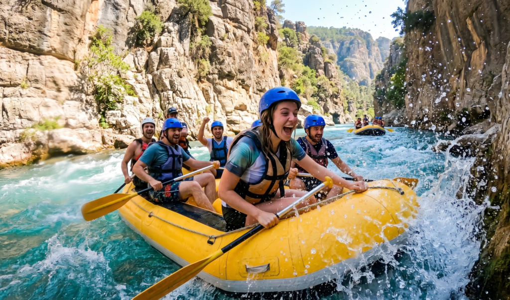
Köprülü Canyon cuts 400 meters deep through the Taurus Mountains, creating Turkey's most sustained whitewater corridor. The standard commercial rafting route runs 14 kilometers from Beşkonak village to the Roman bridge at Oluk, passing 12 named rapid sections and two calm-water pools where paddlers beach for safety briefings and swimming breaks.
Quick answer
Köprülü kanyon rafting kaç km: the full commercial route measures 14 kilometers from the upstream launch point near Beşkonak to the take-out beach below Oluk Bridge. Tour operators typically cover this distance in 2.5 to 3 hours of active paddling, depending on spring snowmelt levels—April and May see higher flow and faster descent times, while August and September offer slower, more controlled runs ideal for families and first-time rafters.
The Köprü River drops 95 vertical meters over the 14-kilometer rafting corridor, creating a gradient steep enough to sustain continuous Class II and occasional Class III rapids without requiring portages or technical maneuvering beyond basic paddle strokes. Most of the elevation loss concentrates in the canyon's middle third, where the riverbed narrows to 12 meters and limestone walls rise vertically on both banks, amplifying wave action and hydraulic features. Köprülü kanyon rafting kaç km becomes a practical question when comparing tour duration to physical effort. The 14-kilometer distance breaks into three unequal segments: a 4-kilometer warm-up stretch with mild current and two practice rapids, an 8-kilometer technical core featuring the canyon's signature wave trains and pour-overs, and a 2-kilometer calm-water exit where the valley opens and rafts drift toward the take-out point. Guides typically beach rafts twice—once at kilometer 6 for a safety check and helmet adjustment, and again at kilometer 11 near the ancient aqueduct ruins where swimmers can cliff-jump from a 5-meter ledge into a deep pool. Spring runoff from Taurus snowpack raises water levels by 40 to 60 centimeters between April and mid-June, reducing the visible rock count from 23 exposed boulders in late summer to fewer than 8 during peak flow. Higher water smooths out several technical sections, turning sharp drops into rolling waves, but also increases the speed at which rafts cover the course—May departures often complete the route in under 2.5 hours, while September groups may spend 3.5 hours on the water when low flow requires more frequent paddling through shallow sections. The canyon's geology dictates route length: Köprü River carved through a karst plateau over two million years, creating a continuous gorge deep enough that no access roads cross the riverbed between Beşkonak and Oluk. This isolation means tour operators cannot offer shorter route options—the 14-kilometer distance represents the only practical put-in and take-out combination that avoids impassable waterfalls upstream and silted irrigation channels downstream. The fixed distance also standardizes pricing across providers, since fuel costs, shuttle logistics and guide ratios remain constant regardless of operator.
“The Köprü River drops 95 vertical meters over 14 kilometers, sustaining continuous rapids without requiring portages or technical maneuvers beyond basic paddle strokes.”
Bu plan, Köprülü Kanyon'da standart rafting deneyimi yaşamak isteyen ziyaretçiler içindir ve toplamda yaklaşık 4-5 saat sürer. Parkur uzunluğu ve deneyim süresi hakkında pratik bilgiler içerir.
Beşkonak'taki rafting merkezine ulaşın ve güvenlik ekipmanlarınızı alın (can yeleği, kask, kürek). Güvenlik brifingleri yaklaşık 15-20 dakika sürer.
Köprübaşı mevkiine minibüslerle transfer edilirsiniz. Yolculuk 10-15 dakika sürer ve Köprüçay nehri manzarası eşliğinde geçer.
Standart parkur 12-14 kilometre uzunluğundadır ve su akıntısına bağlı olarak 2-3 saat sürer. Parkur boyunca 10'dan fazla rapids (hızlı su) geçişi yaparsınız.
Parkurun sonunda kıyıya çıkarsınız ve yakındaki tesislerde öğle yemeği molası verebilirsiniz. Çoğu tur operatörü bu noktada yemek hizmeti sunar.
Tur boyunca çekilen fotoğraflar gözden geçirilir ve dijital kopyalar verilir. Buradan Beşkonak merkeze veya kaldığınız bölgeye dönüş yaparsınız.
Köprülü Kanyon'da güvenli ve konforlu bir rafting deneyimi için doğru ekipmanı hazırlayın.
Everything you need to know about köprülü kanyon rafting kaç km
The rafting course generally covers approximately 12 to 14 kilometers of the Köprüçay River. This stretch offers a balance of excitement and scenery for visitors.
A full rafting excursion typically takes several hours depending on water flow and group pace. You should plan for a significant portion of your day to be dedicated to the activity and safety briefings.
The river course features moderate rapids, making the köprülü kanyon rafting kaç km route quite popular for beginners and families. Professional guides provide necessary instruction to ensure a safe journey down the water.
It is recommended to bring secure water shoes, swimwear, a towel, and sunscreen for your river adventure. Many visitors also bring a change of dry clothes for after the trip.
Stopping to swim is often a highlight of the köprülü kanyon rafting kaç km journey, as there are calmer sections along the river. Your guide will indicate safe points where you can enjoy the water.
Best Koprulu Canyon Rafting Operators
Read more Tickets & toursAntalya Rafting Tours
Read more GuideIs Rafting in Koprulu Canyon Dangerous?
Read more GuideHow to Get to Koprulu Canyon for Rafting
Read more GuideThe Koprulu Canyon Rafting Course
Read more GuideKoprulu Canyon Rafting Prices
Read more